Hazard Map Bern
How often are possible damages caused by natural
hazards in my area?
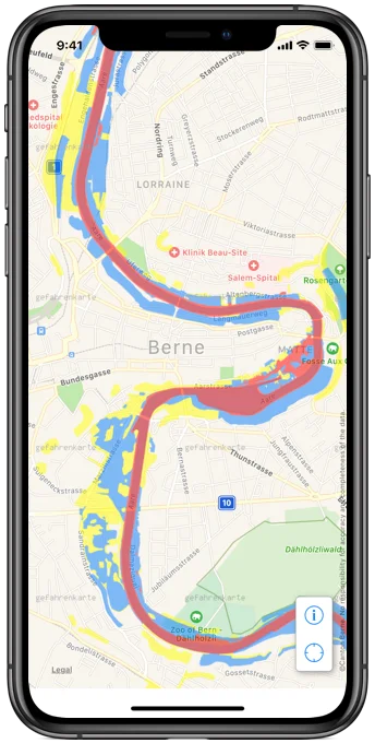
Hazard Map shows the possible zones of impact and the hazard levels of natural hazards as an overlay for the Canton of Bern. It provides a detailed overview of the area of impact, the intensity and the probability of occurrence of natural hazards that can endanger a specific area. They depict not only known, but also potential events, considering events with a return period of up to 300 years.
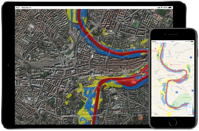
The following layers are overlaid on the iOS standard map
- Synoptic hazard map
- Synoptic hazard indication map
- Perimeter in which detailed investigations were carried out
New in Version 2.1
- Updated natural hazard map (as of March 2018)
- Centre map on current location
- Updated for iOS 12 and Swift 4.1
Apple, the Apple logo, Apple TV, Apple Watch, iPad, iPhone, iPod, iPod touch, iTunes, the iTunes logo, Mac, and QuickTime are trademarks of Apple Inc., registered in the U.S. and other countries. Multi-Touch is a trademark of Apple Inc. App Store is a service mark of Apple Inc., registered in the U.S. and other countries. IOS is a trademark or registered trademark of Cisco in the U.S. and other countries and is used under license.